Article de blogue en français ici
Borealis upgraded to version 5.13 on May 24, 2023.
This upgrade brings several new features, including:
- New DDI import scripts and changed Alternative Title field to be repeatable to support the Odesi migration*
- Improved French translations for menus and hover text*
- Metadata fields “Production Location” is now repeatable, facetable, and enabled for advanced search [expanded below]
- Additional support for NetCDF and HDF5 file detection [expanded below]
- New support for Electronic Lab Notebooks .eln file format detection [expanded below]
- Geospatial Search through API [expanded below]
- Schema.org improvements to improve compliance
- Bug fixes and improved security and performance
* = includes contributions from Borealis team
To test these features, feel free to use our demo sandbox environment which was upgraded on May 12.
Full details about the new features and changes can be found in the IQSS GitHub Release page for 5.13 (English only). Please note that not all of the features available will be enabled in Borealis.
Please reach out if you have any questions or feedback.
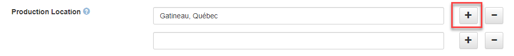
Metadata field “Production Location” is now repeatable, facetable, and enabled for advanced search
What is it?
Depositors can now enter multiple instances of the metadata field "Production Location" in the citation metadata block. Additionally, this field now appears on the Advanced Search page and can be added to the list of search facets.
What is the use-case?
In alignment with similar metadata fields, this update allows depositors to define multiple instances of the “Production Location” fields, and also allows users to refine searches based on the content in the field and use the field in the Advanced Search option.
How do I access this feature?
When entering metadata in the main citation metadata block, click the plus sign to add the multiple instances of the field.
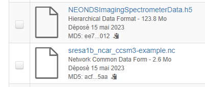
Support for NetCDF and HDF5 file detection
What is it?
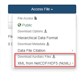
Previously, the Dataverse software detected NetCDF and HDF5 files based on the file extension. With this upgrade, NetCDF and HDF5 files are now detected based on their content to better support the deposit, sharing, and previewing of these file types. Additionally, the Dataverse software will attempt to extract metadata in NcML (XML) format and save it as an auxiliary file.
What is the use-case?
NetCDF (Network Common Data Form) is a machine independent data format and an international standard of the Open Geospatial Consortium.
HDF (Hierarchical Data Format) is an open source file format that supports large and complex data.
How do I access this feature?
Upon uploading these file formats, the software will detect the format. Note: Older HDF4 files are only detected based on the file extension. Stay tuned for more details about NetCDF and HDF file previewers.
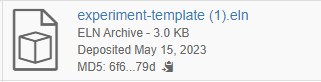
Support for .eln (Electronic Laboratory Notebooks) file detection
What is it?
The Dataverse software now detects .eln file format to better support the deposit, sharing, and previewing of Electronic Lab Notebooks.
What is the use-case?
The ELN file format was developed to improve interoperability among different ELN software. This archive format allows for the import/export of research data, such as experimental results, protocols, descriptions, templates, etc.
How do I access this feature?
Uploading .eln files are detected in the system. Stay tuned for more details about the file previewers.
Geospatial Search through API
What is it?
Geospatial search is supported via the Search API through two new parameters: geo_point and geo_radius.
What is the use-case?
For researchers who would like to search for datasets with a specific geospatial reference.
How do I access this feature?
The metadata fields that are geospatially indexed are “West Longitude,” “East Longitude,” “North Latitude,” and “South Latitude,” which can be found in the “Geographic Bounding Box” field in the “Geospatial Metadata” block.
The documentation for the Search API provides details about the new geo parameters. The geo_point parameter supplies the latitude and longitude and the geo_radius supplies the radial distance in kilometers from geo_point.
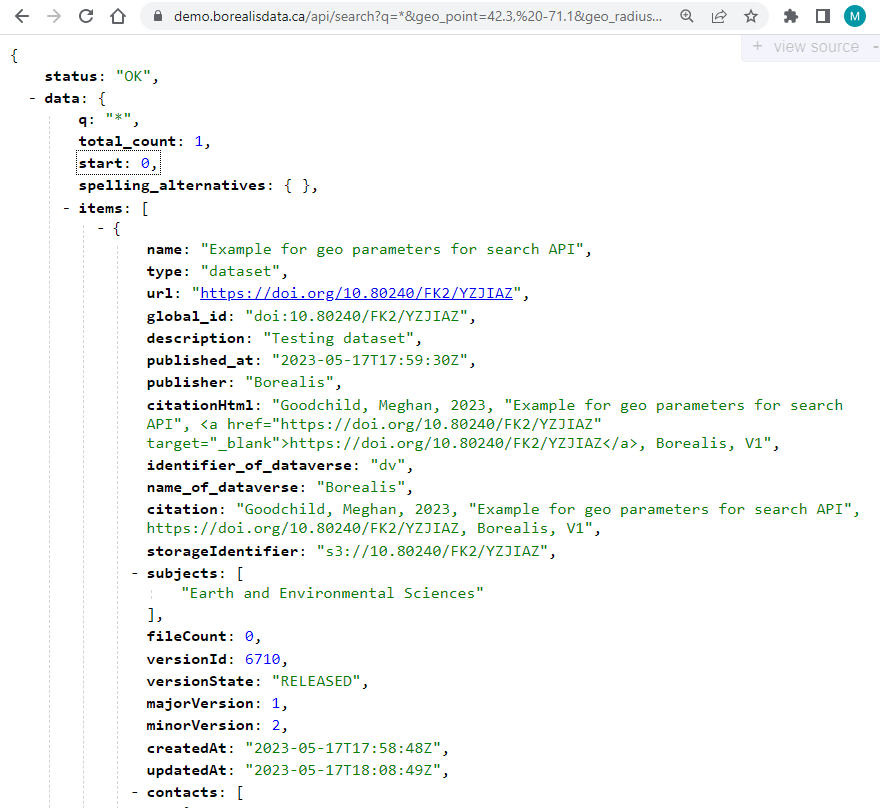
An example search using the browser:
https://demo.borealisdata.ca/api/search?q=*&geo_point=42.3
, -71.1&geo_radius=1.5
The search will result in the JSON output in the browser that will show the results (as displayed in the screenshot below).